|
Tuntutuliak
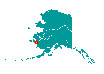
Tuntutuliak is on the Qinaq River,
approximately 3 miles from its confluence with the Kuskokwim River,
about 40 miles from the Bering Sea coast. It lies 40 miles southwest of
Bethel and 440 miles west of Anchorage. It lies at approximately 60° 22'
N Latitude, 162° 38' W Longitude (Sec. 21, T003N, R077W, Seward
Meridian). The community is located in the Bethel Recording District.
The area encompasses 27 sq. miles of land and 0 sq. miles of water.
 The
village's Yup'ik name is Tuntutuliaq, meaning "place of many reindeer."
It was originally located four miles to the east and called Qinaq, as
noted in 1879 by Edward Nelson who found 175 residents at that time. In
1908, a Moravian missionary visited the village and found 130 people
living there. In 1909 a BIA school was built, and the first teacher was
well liked in the community. Due to lack of confidence in the subsequent
teachers, the school was closed in 1917 and the building moved to the
village of Eek. It is thought that some Qinaq villagers may have moved
to Eek so their children could attend school. In 1923 the first Moravian
Chapel was built, with lumber and other support from Eek. In the late
1920s a trading post and store was opened by John Johnson. The community
moved to its present site on higher ground and was renamed Tuntutuliak
in 1945. The BIA built a school in 1957. A post office opened in 1960. The
village's Yup'ik name is Tuntutuliaq, meaning "place of many reindeer."
It was originally located four miles to the east and called Qinaq, as
noted in 1879 by Edward Nelson who found 175 residents at that time. In
1908, a Moravian missionary visited the village and found 130 people
living there. In 1909 a BIA school was built, and the first teacher was
well liked in the community. Due to lack of confidence in the subsequent
teachers, the school was closed in 1917 and the building moved to the
village of Eek. It is thought that some Qinaq villagers may have moved
to Eek so their children could attend school. In 1923 the first Moravian
Chapel was built, with lumber and other support from Eek. In the late
1920s a trading post and store was opened by John Johnson. The community
moved to its present site on higher ground and was renamed Tuntutuliak
in 1945. The BIA built a school in 1957. A post office opened in 1960.
|