|
Tazlina
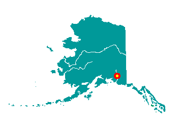 Tazlina
is located 5 miles south of Glennallen on the Richardson Highway, at
mile 110.5. It is comprised of several small residential subdivisions
and a business district. Copperville, Aspen Valley, Tazlina Terrace and
Copper Valley School Road are all part of this area. It lies at
approximately 62° 04' N Latitude, 146° 27' W Longitude (Sec. 21, T003N,
R001W, Copper River Meridian). The community is located in the Chitina
Recording District. The area encompasses 13 sq. miles of land and 1 sq.
miles of water. Tazlina
is located 5 miles south of Glennallen on the Richardson Highway, at
mile 110.5. It is comprised of several small residential subdivisions
and a business district. Copperville, Aspen Valley, Tazlina Terrace and
Copper Valley School Road are all part of this area. It lies at
approximately 62° 04' N Latitude, 146° 27' W Longitude (Sec. 21, T003N,
R001W, Copper River Meridian). The community is located in the Chitina
Recording District. The area encompasses 13 sq. miles of land and 1 sq.
miles of water.
The village reportedly was a fishing
camp of the Ahtna Indian tribes who historically moved up and down the
Copper River and its tributaries. Tazlina is Athabascan for "swift
water." By 1900 a permanent village had been established on the north
and south banks off the Tazlina River near its confluence with the
Copper River. During the pipeline era, Tazlina developed around the old
Copper Valley School, built to board students from all over the state.
It closed in 1971, when local high schools were constructed in the
remote areas of the state and boarding schools were discontinued.
|