|
Metlakatla
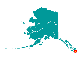 Metlakatla
is located at Port Chester on the west coast of Annette Island, 15 miles
south of Ketchikan. By air, it is 3.5 hours from Anchorage and 1.5 hours
from Seattle. It lies at approximately 55° 07' N Latitude, 131° 34' W
Longitude (Sec. 05, T078S, R092E, Copper River Meridian). The community
is located in the Ketchikan Recording District. The area encompasses 129
sq. miles of land and 68 sq. miles of water. Metlakatla
is located at Port Chester on the west coast of Annette Island, 15 miles
south of Ketchikan. By air, it is 3.5 hours from Anchorage and 1.5 hours
from Seattle. It lies at approximately 55° 07' N Latitude, 131° 34' W
Longitude (Sec. 05, T078S, R092E, Copper River Meridian). The community
is located in the Ketchikan Recording District. The area encompasses 129
sq. miles of land and 68 sq. miles of water.
Metlakatla means "saltwater channel
passage," and was founded by a group of Canadian Tsimshians who migrated
from Prince Rupert, British Columbia in 1887 seeking religious freedom.
They were led by a Scottish lay priest in the Anglican Church (Church of
England), Reverend William Duncan, who had begun his missionary work
with the Tsimshians at Fort Simpson, B.C., in 1857. Rev. Duncan traveled
to Washington D.C. around 1886 to personally request land from President
Grover Cleveland for the Tsimshians. The Island was selected by a local
search committee, and by 1890, there were 823 residents. Congress
declared Annette Island a federal Indian reservation in 1891. Residents
built a church, a school, a sawmill and a cannery, and constructed homes
in an orderly grid pattern. Duncan continued to inspire and lead his
followers until his death in 1918. In 1927, the community built a
hydroelectric plant. During World War II, the U.S. Army constructed a
large air base a few miles from town, which was later used for
commercial amphibian flights to Ketchikan. The U.S. Coast Guard also
maintained a base on the Island until 1976. The Annette Island Reserve
remains the only federal reservation for indigenous peoples in Alaska.
|