|
Homer
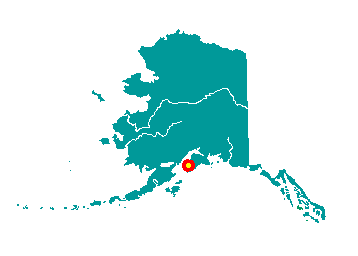
Homer is located on the north shore of
Kachemak Bay on the southwestern Kenai Peninsula. The Homer Spit, a
4.5-mile long bar of gravel, extends from the Homer shoreline. It is 227
road miles south of Anchorage, at the southern-most point of the
Sterling Highway. It lies at approximately 59° 38' N Latitude, 151° 33'
W Longitude (Sec. 19, T006S, R013W, Seward Meridian). The community is
located in the Homer Recording District. The area encompasses 11 sq.
miles of land and 16 sq. miles of water.
 The
Homer area has been homes to Kenaitze Indians for thousands of years. In
1895 the U.S. Geological Survey arrived to study coal and gold
resources. Prospectors bound for Hope and Sunrise disembarked at the
Homer Spit. The community was named for Homer Pennock, a gold mining
company promoter, who arrived in 1896 and built living quarters for his
crew of 50 on the Spit. Their plans were to mine the beach sands along
Cook Inlet, from Homer to Ninilchik. The Homer post office opened
shortly thereafter. In 1899, Cook Inlet Coal Fields Company built a town
and dock on the Spit, a coal mine at Homer's Bluff Point, and a
7-mile-long railroad which carried the coal to the end of Homer Spit.
Various coal mining operations continued until World War I, and settlers
continued to trickle into the area, some to homestead in the 1930s and
40s, other to work in the canneries built to process Cook Inlet fish.
Coal provided fuel for homes, and there is still an estimated 400
million tons of coal deposits in the vicinity of Homer. After then Good
Friday earthquake in 1964, the Homer Spit sunk approximately 4 to 6
feet, and several buildings had to be relocated. The
Homer area has been homes to Kenaitze Indians for thousands of years. In
1895 the U.S. Geological Survey arrived to study coal and gold
resources. Prospectors bound for Hope and Sunrise disembarked at the
Homer Spit. The community was named for Homer Pennock, a gold mining
company promoter, who arrived in 1896 and built living quarters for his
crew of 50 on the Spit. Their plans were to mine the beach sands along
Cook Inlet, from Homer to Ninilchik. The Homer post office opened
shortly thereafter. In 1899, Cook Inlet Coal Fields Company built a town
and dock on the Spit, a coal mine at Homer's Bluff Point, and a
7-mile-long railroad which carried the coal to the end of Homer Spit.
Various coal mining operations continued until World War I, and settlers
continued to trickle into the area, some to homestead in the 1930s and
40s, other to work in the canneries built to process Cook Inlet fish.
Coal provided fuel for homes, and there is still an estimated 400
million tons of coal deposits in the vicinity of Homer. After then Good
Friday earthquake in 1964, the Homer Spit sunk approximately 4 to 6
feet, and several buildings had to be relocated.
|