|
|
|
Eagle
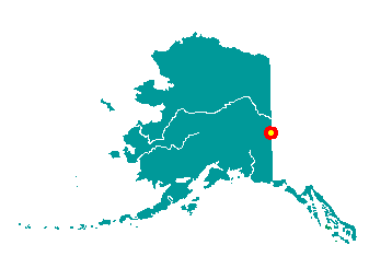
The City of Eagle and Eagle Village are
located on the Taylor Highway, 12 miles west of the Alaska-Canadian
border. Eagle is on the left bank of the Yukon River at the mouth of
Mission Creek. The Yukon-Charley Rivers National Preserve is northwest
of the area. It lies at approximately 64° 47' N Latitude, 141° 12' W
Longitude (Sec. 31, T001S, R033E, Fairbanks Meridian). The community is
located in the Fairbanks Recording District. The area encompasses 1 sq.
miles of land and 0 sq. miles of water.
 The
area has been the historical home to Han Kutchin Indians. Established as
a log house trading station called "Belle Isle" around 1874, it operated
intermittently as a supply and trading center for miners working the
upper Yukon and its tributaries. Eagle City was founded in 1897, and was
named after the nesting eagles on nearby Eagle Bluff. By 1898, the
population had grown to over 1,700. Eagle was the first incorporated
city in the Interior, in January 1901. A U.S. Army camp was established
in 1899, and Fort Egbert was completed in 1900. The Valdez-Eagle
Telegraph line was completed in 1903. By 1910, Fairbanks and Nome gold
prospects had lured away many, and the population had declined to 178.
Fort Egbert was abandoned in 1911. The
area has been the historical home to Han Kutchin Indians. Established as
a log house trading station called "Belle Isle" around 1874, it operated
intermittently as a supply and trading center for miners working the
upper Yukon and its tributaries. Eagle City was founded in 1897, and was
named after the nesting eagles on nearby Eagle Bluff. By 1898, the
population had grown to over 1,700. Eagle was the first incorporated
city in the Interior, in January 1901. A U.S. Army camp was established
in 1899, and Fort Egbert was completed in 1900. The Valdez-Eagle
Telegraph line was completed in 1903. By 1910, Fairbanks and Nome gold
prospects had lured away many, and the population had declined to 178.
Fort Egbert was abandoned in 1911.
|
|
|