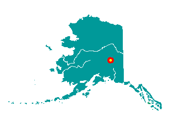
Delta Junction is located at the
convergence of the Richardson and Alaska Highways, approximately 95
miles southeast of Fairbanks. The City developed along the east bank of
the Delta River, south of its junction with the Tanana River. It offers
spectacular views of the Alaska Range. It lies at approximately
64.037780° North Latitude and -145.73222° West Longitude. (Sec. 23,
T010S, R010E, Fairbanks Meridian.) Delta Junction is located in the
Fairbanks Recording District. The area encompasses 17.3 sq. miles of
land and 0.0 sq. miles of water. This area of Interior Alaska
experiences seasonal extremes. The average low temperature in January is
-11 degrees Fahrenheit. The average high during July is 69 degrees
Fahrenheit. Temperature extremes ranging from a low of -63 to a high of
92 degrees Fahrenheit have been recorded. Average annual liquid
equivalent precipitation is 12 inches, which includes an average annual
snowfall of 37 inches.
Tanana Athabascan Indians occupied this site throughout most of the
19th and early 20th centuries.
 In
1899 the Army sent parties to investigate the Susitna, Matanuska, and
Copper River valleys to find the best route for a trail north from
Valdez, through the Copper River valley. By 1901, the Army had completed
the Trans-Alaska Military Road, which extended from Valdez to Eagle
City.
In
1899 the Army sent parties to investigate the Susitna, Matanuska, and
Copper River valleys to find the best route for a trail north from
Valdez, through the Copper River valley. By 1901, the Army had completed
the Trans-Alaska Military Road, which extended from Valdez to Eagle
City.
In 1902, gold was discovered in the Tanana Valley and, shortly after,
a spur trail was created from Gulkana on the Valdez-Eagle route to the
new mining camp in Fairbanks. This trail became the Valdez-Fairbanks
Trail. The Sullivan Roadhouse was built in 1905 by John and Florence
Sullivan on a part of the Valdez-Fairbanks Trail known as the
Donnelly-Washburn Cut-Off. This section of the trail was considered by
many to be too steep, and the Alaska Road Commission built a new road
which was removed from the Sullivan Roadhouse by a distance of four
miles. The Sullivans tore the roadhouse apart and rebuilt it alongside
the new road. Ongoing mining activity just north of Delta Junction in
the Tenderfoot area, and the Chisana Gold Strike of 1913, brought many
prospectors and other travelers through the area.
The Delta Junction area became known as Buffalo Center for the
American bison that were transplanted here from the National Bison Range
in Montana in the 1920s. In 1942, construction of the Alaska Highway
began, and Fort Greely military base was completed 5 miles to the south.
In 1946, a dairy farm was established; beef cattle were brought in
during 1953 by homesteaders. Delta Junction was incorporated as a
second-class city in 1960. Construction of the Trans-Alaska Pipeline
between 1974 and 1977 brought a dramatic upswing to the population and
economy.
In August 1978, the state initiated Delta Agricultural Project I, a
60,000-acre demonstration agricultural project. Twenty-two parcels,
averaging 2,700 acres in size were sold by lottery. Delta Agricultural
Project II, an additional land release of 15 parcels totaling 25,000
acres, took place in early 1982. Success of the Delta Agricultural
Projects has been highly variable. In 1980, the 70,000-acre Delta Bison
Range was created to confine the bison and keep them out of the barley
fields. About 6,000-11,000 people apply each year for an average of 40
permits to hunt Delta bison. Delta bison have been used to start three
other herds in Alaska.
In 2004, the U.S. Army Corps of Engineers completed construction of
the Missile Defense Testbed at Fort Greely. It is anticipated that new
jobs will be created with the development of the Pogo mine, expected to
be operational by mid-2006.