|
Crooked Creek
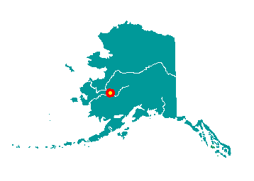
Crooked Creek is located on the north bank
of the Kuskokwim River at its junction with Crooked Creek. It lies in
the Kilbuk-Kuskokwim Mountains 50 miles northeast of Aniak, 141 miles
northeast of Bethel, and 275 miles west of Anchorage. It lies at
approximately 61° 52' N Latitude, 158° 06' W Longitude (Sec. 32, T021N,
R048W, Seward Meridian). The community is located in the Fairbanks
Recording District. The area encompasses 40 sq. miles of land and 3 sq.
miles of water.
 It
was first reported in 1844 by the Russian explorer Zagoskin, who
recorded the name of the creek as "Kvikchagpak," or "great bend" in
Yup'ik, and as "Khottylno," or "sharp turn" in Ingalik Indian. He noted
that the site was used as a summer fish camp for the nearby villagers of
Kwigiumpainukamuit. In 1909, a permanent settlement was established as a
way station for the Flat and Iditarod gold mining camps. The USGS
reported it in 1910 as "Portage Village" because it was at the south end
of a portage route up Crooked Creek to the placer mines. In 1914, Denis
Parent founded a trading post upriver from the creek mouth, in what
would become the "upper village" of Crooked Creek. A post office was
opened in 1927 and a school was built in 1928. The "lower village" was
settled by Eskimos and Ingalik Indians. By the early 1940s, there was a
Russian Orthodox Church, St. Nicholas Chapel, and several homes. The
upper and lower portions of the village remain today. Gold production
continued through the late 1980s, when Western Gold Mining and
Exploration went out of business. It
was first reported in 1844 by the Russian explorer Zagoskin, who
recorded the name of the creek as "Kvikchagpak," or "great bend" in
Yup'ik, and as "Khottylno," or "sharp turn" in Ingalik Indian. He noted
that the site was used as a summer fish camp for the nearby villagers of
Kwigiumpainukamuit. In 1909, a permanent settlement was established as a
way station for the Flat and Iditarod gold mining camps. The USGS
reported it in 1910 as "Portage Village" because it was at the south end
of a portage route up Crooked Creek to the placer mines. In 1914, Denis
Parent founded a trading post upriver from the creek mouth, in what
would become the "upper village" of Crooked Creek. A post office was
opened in 1927 and a school was built in 1928. The "lower village" was
settled by Eskimos and Ingalik Indians. By the early 1940s, there was a
Russian Orthodox Church, St. Nicholas Chapel, and several homes. The
upper and lower portions of the village remain today. Gold production
continued through the late 1980s, when Western Gold Mining and
Exploration went out of business.
|