|
Copper Center
 Copper
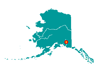
Center is located along the Richardson Highway between Miles 100 and
105. It is on the west bank of the Copper River at the confluence of the
Klutina River. It lies just west of the Wrangell-St. Elias National
Park. It lies at approximately 61░ 59' N Latitude, 145░ 21' W Longitude
(Sec. 18, T002N, R001E, Copper River Meridian). The community is located
in the Chitina Recording District. The area encompasses 21 sq. miles of
land and 0 sq. miles of water. Copper
Center is located along the Richardson Highway between Miles 100 and
105. It is on the west bank of the Copper River at the confluence of the
Klutina River. It lies just west of the Wrangell-St. Elias National
Park. It lies at approximately 61░ 59' N Latitude, 145░ 21' W Longitude
(Sec. 18, T002N, R001E, Copper River Meridian). The community is located
in the Chitina Recording District. The area encompasses 21 sq. miles of
land and 0 sq. miles of water.
The Ahtna people have occupied the
Copper River basin for the past 5,000 to 7,000 years. They had summer
fish camps at every bend in the river and winter villages throughout the
region. Copper Center was a large Ahtna Athabascan village at one time.
In 1896, Ringwald Blix built Blix Roadhouse, which was very highly
regarded for its outstanding services. The Trail of '98 from Valdez
joined with the Eagle Trail to Forty Mile and Dawson. 300 destitute
miners spent the winter here, and many died of scurvy. Copper Center
became the principal supply center for miners in the Nelchina-Susitna
region. A telegraph station and post office were established in 1901. A
school was constructed in 1905, which brought a number of Native
families to Copper Center. In 1909, it was designated a government
agricultural experiment station. In 1932, the original roadhouse was
destroyed in order to build the Copper Center Lodge. This lodge is on
the National Register of Historic Roadhouses and is now considered the
jewel of Alaskan roadhouses. In the late 30s and early 40s, construction
of the Richardson and Glenn Highways made the region more accessible.
The first church in the Copper River region, the Chapel on the Hill, was
built here in 1942 by Vince Joy and U.S. Army volunteers stationed in
the area. Mr. Joy built other churches and a bible college in the area
over the years.
|