|
Aleknagik
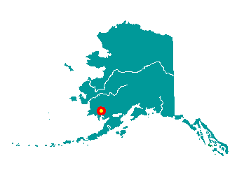
Aleknagik is located at the head of Wood
River on the southeast end of Lake Aleknagik, 16 miles northwest of
Dillingham. It lies at approximately 59° 17' N Latitude, 158° 36' W
Longitude (Sec. 31, T010S, R055W, Seward Meridian). The community is
located in the Bristol Bay Recording District. The area encompasses 12
sq. miles of land and 7 sq. miles of water.
 Wood
River and Aleknagik Lake have been used historically as summer fish
camps. Aleknagik means "Wrong Way Home," because Natives returning to
their homes along the Nushagak River would sometimes become lost in the
fog and find themselves swept up the Wood River with the tide,
inadvertently arriving at Aleknagik Lake. The 1929 U.S. Census found 55
people living in the "Wood River village" area to the south. During
1930, their were five families living on the shores of the lake
year-round, the Waskeys. Polleys, Hansons, Yakos, and Smiths. A log
cabin territorial school was built on the south shore of the lake in
1933, and Josie Waskey was the first teacher. Attracted by the school,
other facilities, and plentiful fish, game and timber, a number of
families from Goodnews, Togiak, and Kulukak area relocated to Aleknagik.
A post office was established in 1937. A two-story framed school with a
teacher apartment was constructed in 1938. By 1939, Aleknagik had 78
residents, over 30 buildings, and a small sawmill. In the late 1940s, a
Seventh-Day Adventist Mission and School was established on the north
shore. During the 1950s, a Moravian Church and a Russian Orthodox Church
were built in Aleknagik and over 35 families lived along the lake. In
1959, the state constructed a 25-mile road connecting the south shore to
Dillingham. The road was passable only during the summer months, until
the late 1980s, when it was upgraded and maintained year-round. Wood
River and Aleknagik Lake have been used historically as summer fish
camps. Aleknagik means "Wrong Way Home," because Natives returning to
their homes along the Nushagak River would sometimes become lost in the
fog and find themselves swept up the Wood River with the tide,
inadvertently arriving at Aleknagik Lake. The 1929 U.S. Census found 55
people living in the "Wood River village" area to the south. During
1930, their were five families living on the shores of the lake
year-round, the Waskeys. Polleys, Hansons, Yakos, and Smiths. A log
cabin territorial school was built on the south shore of the lake in
1933, and Josie Waskey was the first teacher. Attracted by the school,
other facilities, and plentiful fish, game and timber, a number of
families from Goodnews, Togiak, and Kulukak area relocated to Aleknagik.
A post office was established in 1937. A two-story framed school with a
teacher apartment was constructed in 1938. By 1939, Aleknagik had 78
residents, over 30 buildings, and a small sawmill. In the late 1940s, a
Seventh-Day Adventist Mission and School was established on the north
shore. During the 1950s, a Moravian Church and a Russian Orthodox Church
were built in Aleknagik and over 35 families lived along the lake. In
1959, the state constructed a 25-mile road connecting the south shore to
Dillingham. The road was passable only during the summer months, until
the late 1980s, when it was upgraded and maintained year-round.
|